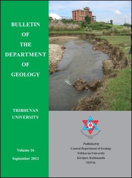
Morpho-hydrologic parameters and classification of the Kodku River for stream stability assessment, southern Kathmandu, Central Nepal
DOI:
https://doi.org/10.3126/bdg.v16i0.8880Keywords:
River stability, hydrology, river morphology, meander wavelength, river classificationAbstract
The Kodku River Corridor is one of the most potential corridors for future development of roads that would link the southern remote areas of the Kathmandu Valley to the inner core areas. River stability is of great concern as the unstable segment of river may pose threat on infrastructures, and adjacent cultivated lands and settlement areas. In this light, the preliminary assessment of the Kodku River as a part of the stability assessment was undertaken. The broad level geomorphic and hydrologic parameters, and Level I and II classifications of the river were made to assess for stability condition.
The Kodku River is a fifth order stream, extending for about 15.86 km and its watershed covering an area of 35.67 sq. km. The relative relief is extremely high to low, and diminishes with change of landforms from steep terrain in the southern part to the gentle sloped terraces in the northern part of the watershed. Drainage texture is fine to very coarse, from the southern to the norther parts of the watershed. All the stream segments are sinuous (K = 1.2) whereas the Arubot Segment is the highly meandering (1.7). Both meander wavelength and belt width increase with increasing stream order. Five types of valleys have been distinguished; I, II, IV, VI, and VIII type valleys. Based on valley type distribution, channel pattern, shape and channel slope, the stream segments have been classified using Level I assessment as ‘B’ type, ‘C’ type and ‘Aa+’ type streams. The ‘B’ type streams are all located in the third order segment. Except the ‘Aa+’ type stream, all the fifth and fourth order stream segments belong to ‘C’ type streams. Width/Depth ratio varying between 10.5 and 29.5 indicates laterally unstable channel segments. The bank height ratio, which varies between 1.6 and 2.4, indicates moderate incision and shows vertical instability of streams. The Badikhel Segment is relatively more entrenched (1.7) while the Taukhel Segment is the least entrenched (7.1). Since Entrenchment Ratio exceeds 1.6, the stream segments are considered to have moderate to low entrenchment. Based on the bed material load, the Kodku River is a gravelly mixed-load river, in which pebbles to silt/clay occur. Level II classification distinguishes three-types of streams; ‘B4c” type (Badikhel Segment), ‘C6c’ type (Taukhel Segment), and ‘C4c” type (Arubot, Thaiba and Harisidhi Segments). The ‘B4c’ type stream has tendency of vertical instability. The ‘C6c” and ‘C4c” type streams have shallow and wide meandering channels with well developed flood plains and lateral bars, and reflect tendency of lateral instability.
DOI: http://dx.doi.org/10.3126/bdg.v16i0.8880
Bulletin of the Department of Geology Vol. 16, 2013, pp. 1–20
Downloads
Downloads
Published
How to Cite
Issue
Section
License
© Central Department of Geology, Tribhuvan University, Nepal

